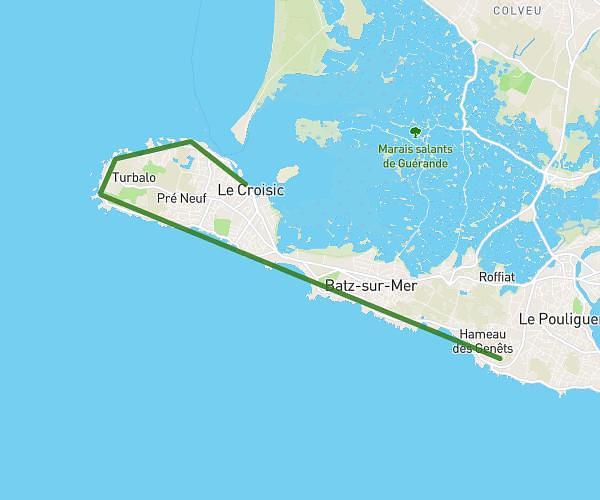
This hiking trail covers 11.87mi starting from Batz-sur-Mer, Loire-Atlantique. The hike does not return to the trailhead and ends near 9 Avenue De Bangor, 44380 Pornichet, France. This hike is rated as moderate, plan for about 4h46m to complete it. The route has an elevation gain of 817ft and an elevation loss of 804ft.
Batz - Pornichet
Route details
2.49mph
Speed
2049 kcal
Calories burned
2.6%
Avg grade
Point to point
Route type
0ft
Min altitude
52ft
Max altitude
Route profile
817ft
Elevation gain
804ft
Elevation loss
0ft
Min altitude
52ft
Max altitude
How to get there
Trailhead: 1 Route De Bérigo, 44740 Batz-sur-Mer, France
GPS coordinates of the trailhead: 47.280878, -2.477464 / 47°16'51'' N, 2°28'38'' W