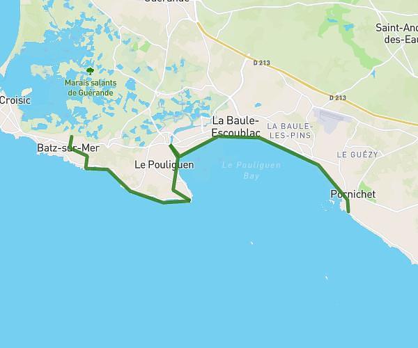
This hiking trail covers 9.453mi starting from Le Pouliguen, Loire-Atlantique. The hike does not return to the trailhead and ends near 8 Quai De La Petite Chambre, 44490 Le Croisic, France. This hike is rated as moderate, plan for about 3h48m to complete it. The route has an elevation gain of 548ft and an elevation loss of 577ft.
J3 Le Pouliguen Le Croisic
Route details
2.49mph
Speed
1627 kcal
Calories burned
2.3%
Avg grade
Point to point
Route type
0ft
Min altitude
52ft
Max altitude
Route profile
548ft
Elevation gain
577ft
Elevation loss
0ft
Min altitude
52ft
Max altitude
How to get there
Trailhead: 5 Impasse Du Scall, 44510 Le Pouliguen, France
GPS coordinates of the trailhead: 47.264675, -2.446794 / 47°15'52'' N, 2°26'48'' W