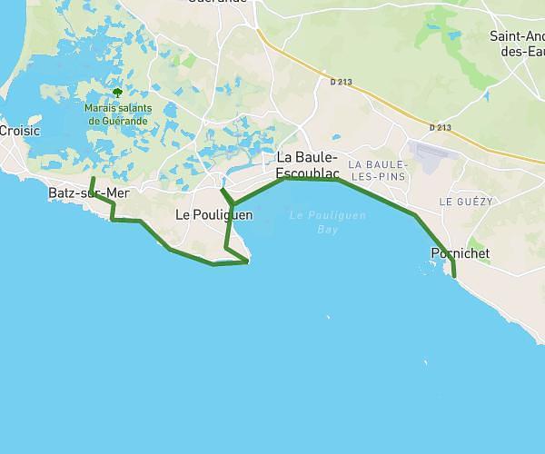
This hiking trail covers 8.044mi starting from Pornichet, Loire-Atlantique. The hike does not return to the trailhead and ends near 12 Rue Ferdinand Buisson, 44600 Saint-Nazaire, France. This hike is rated as hard, plan for about 3h14m to complete it. The route has an elevation gain of 1007ft and an elevation loss of 1024ft.
Pornichet - St Naz
Route details
2.49mph
Speed
1413 kcal
Calories burned
4.8%
Avg grade
Point to point
Route type
0ft
Min altitude
108ft
Max altitude
Route profile
1007ft
Elevation gain
1024ft
Elevation loss
0ft
Min altitude
108ft
Max altitude
How to get there
Trailhead: 7 Avenue Léon Dubas, 44380 Pornichet, France
GPS coordinates of the trailhead: 47.256278, -2.338842 / 47°15'22'' N, 2°20'19'' W