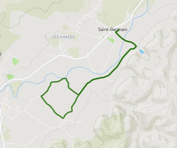
This running route covers 6.556mi starting from Saint-Genest-de-Beauzon, Ardèche. The run is a loop trail and returns to the trailhead. This run is rated as moderate, expect about 1h10m to complete it. The route has an elevation gain of 745ft and an elevation loss of 745ft.
Ardèche
Route details
5.62mph
Speed
800 kcal
Calories burned
Loop trail
Route type
600ft
Min altitude
935ft
Max altitude
Route profile
745ft
Elevation gain
745ft
Elevation loss
600ft
Min altitude
935ft
Max altitude
How to get there
Trailhead: 246 Route De Saint-Genest, 07230 Saint-Genest-de-Beauzon, France
GPS coordinates of the trailhead: 44.457836, 4.191081 / 44°27'28'' N, 4°11'27'' E