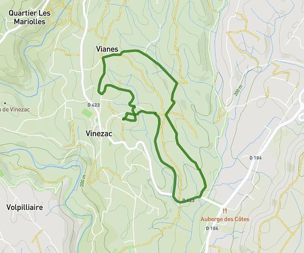
This running route covers 4.368mi starting from Vinezac, Ardèche. The run is a loop trail and returns to the trailhead. This run is rated as easy, expect about 35m8s to complete it. The route has an elevation gain of 138ft and an elevation loss of 157ft.
Vinezac jogg
Route details
7.46mph
Speed
402 kcal
Calories burned
Loop trail
Route type
630ft
Min altitude
787ft
Max altitude
Route profile
138ft
Elevation gain
157ft
Elevation loss
630ft
Min altitude
787ft
Max altitude
How to get there
Trailhead: 120 Chemin Du Lavoir, 07110 Vinezac, France
GPS coordinates of the trailhead: 44.54024, 4.32886 / 44°32'24'' N, 4°19'43'' E