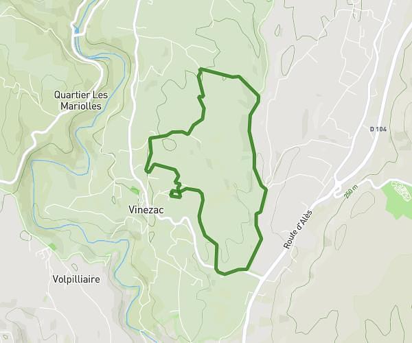
This running route covers 3.22mi starting from Vinezac, Ardèche. The run is a loop trail and returns to the trailhead. This run is rated as easy, expect about 30m to complete it. The route has an elevation gain of 174ft and an elevation loss of 141ft.
vinezac
Route details
6.44mph
Speed
343 kcal
Calories burned
Loop trail
Route type
656ft
Min altitude
797ft
Max altitude
Route profile
174ft
Elevation gain
141ft
Elevation loss
656ft
Min altitude
797ft
Max altitude
How to get there
Trailhead: 380 Chemin Du Lavoir, 07110 Vinezac, France
GPS coordinates of the trailhead: 44.54, 4.32868 / 44°32'23'' N, 4°19'43'' E