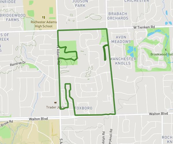
This walking route covers 3.912mi starting from Rochester Hills, Michigan. The walk is a loop trail and returns to the trailhead. This walk is rated as moderate, plan for about 1h3m to complete it. The route has an elevation gain of 108ft and an elevation loss of 108ft.
Local Loop Short
Route details
16:06/mi
Pace
257 kcal
Calories burned
Loop trail
Route type
922ft
Min altitude
974ft
Max altitude
Route profile
108ft
Elevation gain
108ft
Elevation loss
922ft
Min altitude
974ft
Max altitude
How to get there
Trailhead: Snowmass Drive, 48309 Rochester Hills
GPS coordinates of the trailhead: 42.68942, -83.18449 / 42°41'21'' N, 83°11'4'' W