MapPlanner
5.427mi
Distance
1h30m
Duration
16:35/mi
Pace
Hard
Level

First 5 mile challenge

Route details

16:35/mi
Pace
368 kcal
Calories burned
Loop trail
Route type
997ft
Min altitude
1027ft
Max altitude

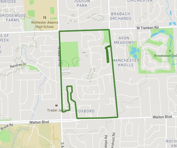
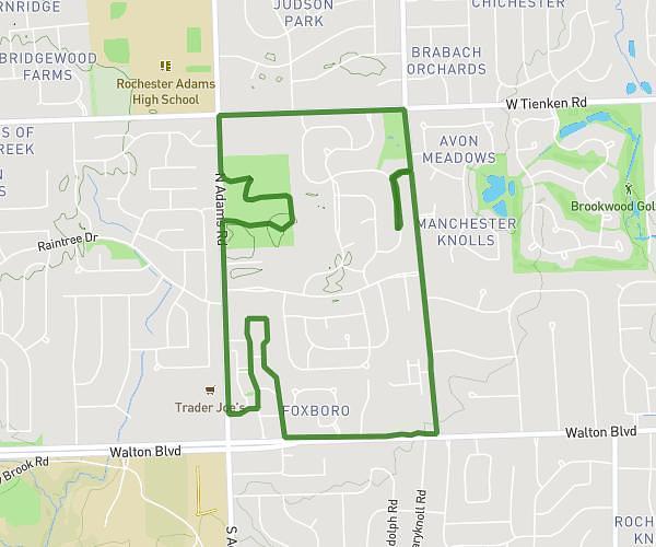
This walking route covers 5.427mi starting from Lake Orion, Michigan. The walk is a loop trail and returns to the trailhead. This walk is rated as hard, plan for about 1h30m to complete it. The route has an elevation gain of 36ft and an elevation loss of 10ft.

Description of the route by the creator

5 miles total, go as fast as possible. complete in under 1 hour and 30 minutes

Route profile

36ft
Elevation gain
10ft
Elevation loss
997ft
Min altitude
1027ft
Max altitude

How to get there

Trailhead: Beech, 48359 Lake Orion

GPS coordinates of the trailhead: 42.73158, -83.31231 / 42°43'53'' N, 83°18'44'' W

Caution: May Cross Private Property

This route may pass through or near private property. Always respect posted signs, obtain permission where required, and follow local trespassing laws. MapPlanner does not guarantee public access along any route.

Safety Notice

Trail and road conditions may change without notice due to weather, construction, or other factors. Always verify current conditions before heading out. You are responsible for your own safety — follow local signage, obey traffic laws, and use your best judgment on the trail.