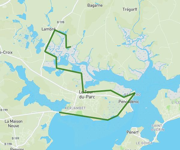
This hiking trail covers 13.167mi starting from Sarzeau, Morbihan. The hike does not return to the trailhead and ends near 2 Rue De Bilouris, 56640 Arzon, France. This hike is rated as moderate, plan for about 4h19m to complete it. The route has an elevation gain of 344ft and an elevation loss of 410ft.
jour 1
Route details
3.05mph
Speed
1828 kcal
Calories burned
1.1%
Avg grade
Point to point
Route type
0ft
Min altitude
115ft
Max altitude
Route profile
344ft
Elevation gain
410ft
Elevation loss
0ft
Min altitude
115ft
Max altitude
How to get there
Trailhead: 2 Ruelle De L'église, 56370 Sarzeau, France
GPS coordinates of the trailhead: 47.527397, -2.768318 / 47°31'38'' N, 2°46'5'' W