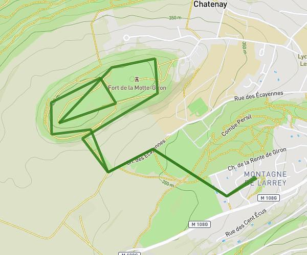
This running route covers 4.117mi starting from Quincey, Côte-d’Or. The run is a loop trail and returns to the trailhead. This run is rated as easy, expect about 44m10s to complete it. The route has an elevation gain of 138ft and an elevation loss of 138ft.
Quincey - agencourt
Route details
5.59mph
Speed
505 kcal
Calories burned
Loop trail
Route type
709ft
Min altitude
751ft
Max altitude
Route profile
138ft
Elevation gain
138ft
Elevation loss
709ft
Min altitude
751ft
Max altitude
How to get there
Trailhead: 32 Grande Rue, 21700 Quincey, France
GPS coordinates of the trailhead: 47.109335, 4.970039 / 47°6'33'' N, 4°58'12'' E