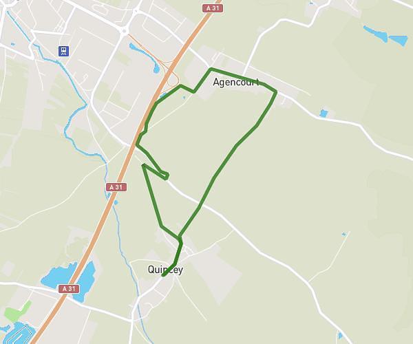
This running route covers 3.314mi starting from Morey-Saint-Denis, Côte-d’Or. The run is a loop trail and returns to the trailhead. This run is rated as easy, expect about 35m33s to complete it. The route has an elevation gain of 207ft and an elevation loss of 203ft.
5km Morey
Route details
5.59mph
Speed
406 kcal
Calories burned
Loop trail
Route type
771ft
Min altitude
892ft
Max altitude
Route profile
207ft
Elevation gain
203ft
Elevation loss
771ft
Min altitude
892ft
Max altitude
How to get there
Trailhead: 5 Route Des Grands Crûs, 21220 Morey-Saint-Denis, France
GPS coordinates of the trailhead: 47.195596, 4.96184 / 47°11'44'' N, 4°57'42'' E