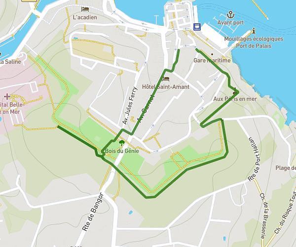
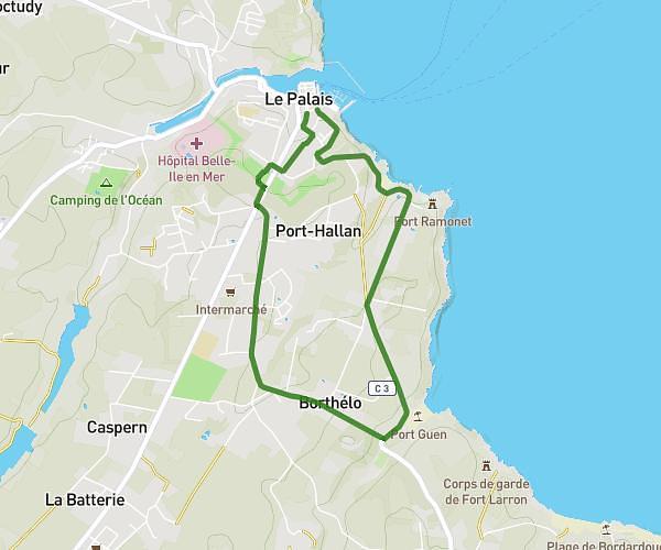
Explore this hiking route of 1.746mi starting from Le Palais, Morbihan. The hike is a loop and returns to the starting point. This hike is rated as easy, plan for about 18m44s to complete it. The route has an elevation gain of 233ft and an elevation loss of 233ft.
hopital
Route details
Route profile
233ft
Elevation gain
233ft
Elevation loss
49ft
Min altitude
144ft
Max altitude
Route information
How to get there
Route starting point: Rue C. Fechant, 56360 Le Palais, France
GPS coordinates of the starting point: 47.346572, -3.153654 / 47°20'47'' N, 3°9'13'' W