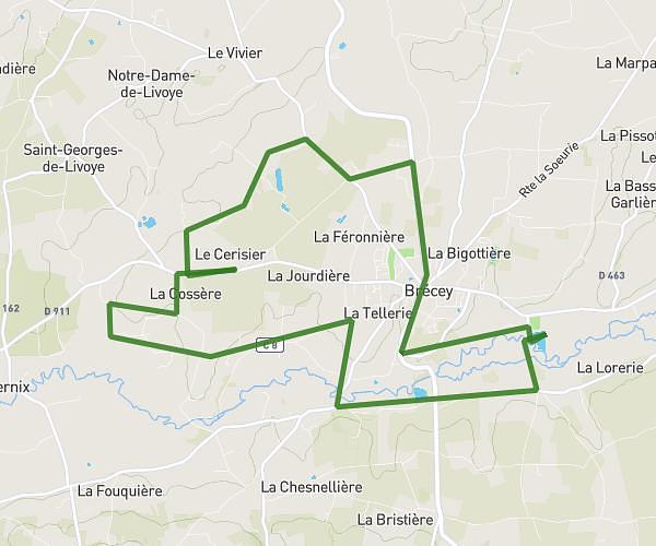
This running route covers 8.95mi starting from Isigny-le-Buat, Manche. The run is a loop trail and returns to the trailhead. This run is rated as hard, expect about 1h12m to complete it. The route has an elevation gain of 249ft and an elevation loss of 210ft.
foret mongothier
Route details
7.46mph
Speed
823 kcal
Calories burned
Loop trail
Route type
174ft
Min altitude
423ft
Max altitude
Route profile
249ft
Elevation gain
210ft
Elevation loss
174ft
Min altitude
423ft
Max altitude
How to get there
Trailhead: Rue De La Normandière, 50540 Isigny-le-Buat
GPS coordinates of the trailhead: 48.62199, -1.1711 / 48°37'19'' N, 1°10'15'' W