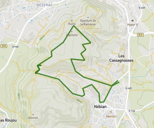
This hiking trail covers 8.717mi starting from Aumelas, Hérault. The hike is a loop trail and returns to the trailhead. This hike is rated as hard, plan for about 3h7m to complete it. The route has an elevation gain of 988ft and an elevation loss of 988ft.
Vendémian
Route details
2.8mph
Speed
1356 kcal
Calories burned
4.3%
Avg grade
Loop trail
Route type
423ft
Min altitude
974ft
Max altitude
Route profile
988ft
Elevation gain
988ft
Elevation loss
423ft
Min altitude
974ft
Max altitude
How to get there
Trailhead: Route Des Mas, 34230 Aumelas, France
GPS coordinates of the trailhead: 43.56181, 3.6168 / 43°33'42'' N, 3°37'0'' E