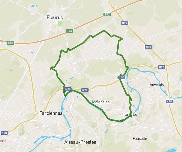
This running route covers 8.7mi starting from Sambreville, Namur. The run is a loop trail and returns to the trailhead. This run is rated as hard, expect about 1h33m to complete it. The route has an elevation gain of 482ft and an elevation loss of 489ft.
Parcours 4 mars
Route details
5.61mph
Speed
1063 kcal
Calories burned
Loop trail
Route type
295ft
Min altitude
584ft
Max altitude
Route profile
482ft
Elevation gain
489ft
Elevation loss
295ft
Min altitude
584ft
Max altitude
How to get there
Trailhead: Rue Des Prairies 18, 5060 Sambreville, Namur, Belgium
GPS coordinates of the trailhead: 50.429835, 4.610816 / 50°25'47'' N, 4°36'38'' E