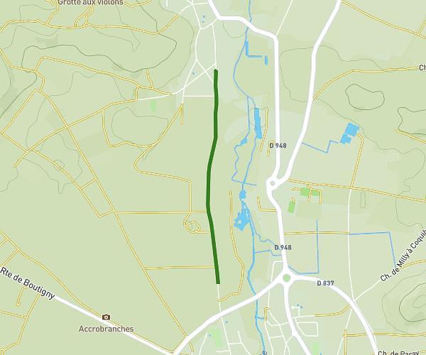
This hiking trail covers 4.044mi starting from Savigny-le-Temple, Seine-et-Marne. The hike is a loop trail and returns to the trailhead. This hike is rated as easy, plan for about 1h37m to complete it. The route has an elevation gain of 118ft and an elevation loss of 118ft.
foret de Rougeau 6,5km
Route details
2.49mph
Speed
690 kcal
Calories burned
1.1%
Avg grade
Loop trail
Route type
285ft
Min altitude
308ft
Max altitude
Route profile
118ft
Elevation gain
118ft
Elevation loss
285ft
Min altitude
308ft
Max altitude
How to get there
Trailhead: Chemin Des Maisons Forestières, 77176 Savigny-le-Temple, France
GPS coordinates of the trailhead: 48.598965, 2.547416 / 48°35'56'' N, 2°32'50'' E