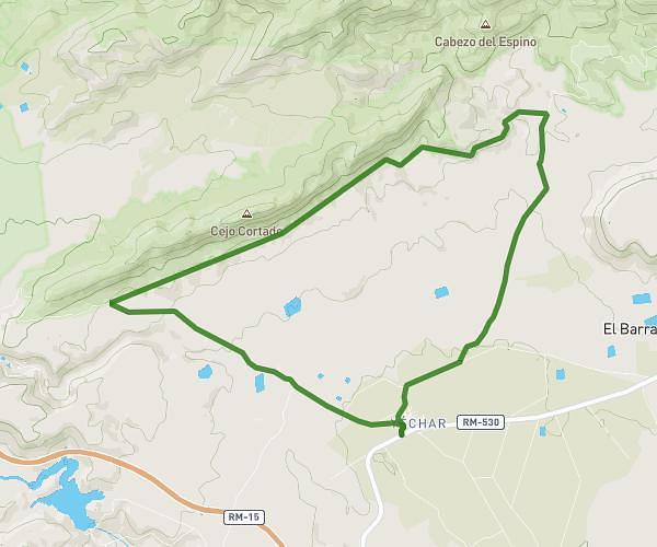
This running route covers 10.82mi starting from Albudeite, Murcia. The run does not return to the trailhead and ends near Paseo De La Constitución 2, 30190 Albudeite, Murcia, Spain. This run is rated as hard, expect about 1h56m to complete it. The route has an elevation gain of 328ft and an elevation loss of 331ft.
Trail Albudeite
Route details
5.6mph
Speed
1326 kcal
Calories burned
Point to point
Route type
659ft
Min altitude
955ft
Max altitude
Route profile
328ft
Elevation gain
331ft
Elevation loss
659ft
Min altitude
955ft
Max altitude
How to get there
Trailhead: Avenida De La Paz 53, 30190 Albudeite, Murcia, Spain
GPS coordinates of the trailhead: 38.031821, -1.388568 / 38°1'54'' N, 1°23'18'' W