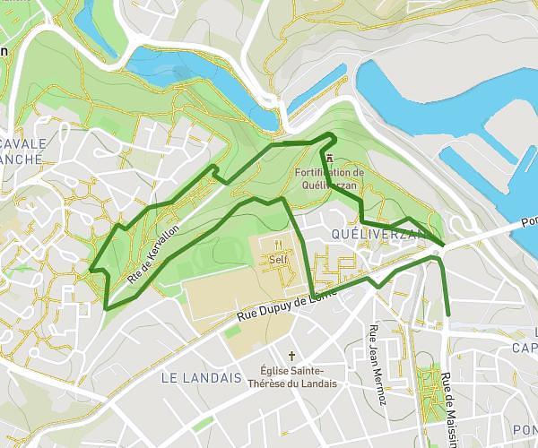
This running route covers 6.373mi starting from Ploudalmézeau, Finistère. The run is a loop trail and returns to the trailhead. This run is rated as moderate, expect about 1h8m to complete it. The route has an elevation gain of 400ft and an elevation loss of 400ft.
Marche Ploudal
Route details
5.62mph
Speed
777 kcal
Calories burned
Loop trail
Route type
10ft
Min altitude
180ft
Max altitude
Route profile
400ft
Elevation gain
400ft
Elevation loss
10ft
Min altitude
180ft
Max altitude
How to get there
Trailhead: 1 Rue De Keruscat, 29830 Ploudalmézeau, France
GPS coordinates of the trailhead: 48.539813, -4.665335 / 48°32'23'' N, 4°39'55'' W