MapPlanner
25.895mi
Distance
2h
Duration
12.95mph
Speed
+203ft
Elevation gain
-167ft
Elevation loss
Moderate
Level

2025 HHHH 25-50mi Route

Route details

1052 kcal
Calories burned
0.3%
Avg grade
Loop trail
Route type
433ft
Min altitude
568ft
Max altitude

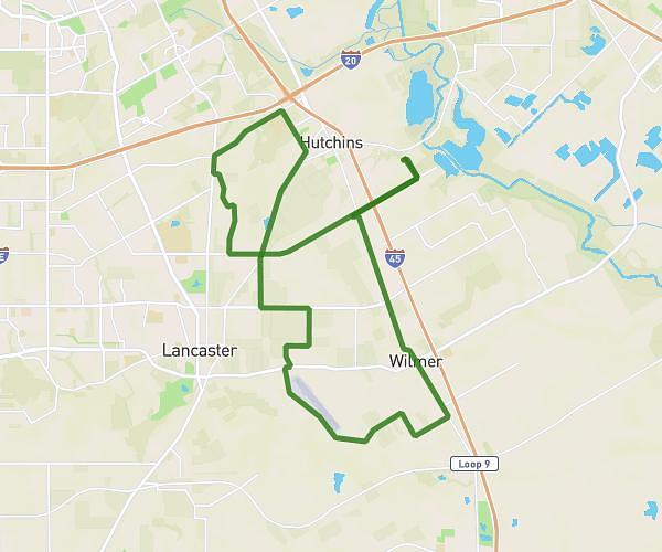
This cycling route covers 25.895mi starting from Hutchins, Texas. The ride is a loop trail and returns to the trailhead. This route is rated as moderate, plan for about 2h to complete it. The route has an elevation gain of 203ft and an elevation loss of 167ft.

Description of the route by the creator

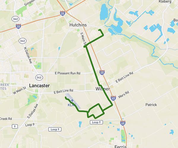
Same route as previous from 25-50, but after the rest stop and onto Van you'll go right on Mason and then left on Lavender to take Miller's Ferry back in.

Route profile

203ft
Elevation gain
167ft
Elevation loss
433ft
Min altitude
568ft
Max altitude

How to get there

Trailhead: 1601 Burns Drive, Hutchins, Texas 75141, United States

GPS coordinates of the trailhead: 32.644406, -96.689442 / 32°38'39'' N, 96°41'21'' W

Caution: May Cross Private Property

This route may pass through or near private property. Always respect posted signs, obtain permission where required, and follow local trespassing laws. MapPlanner does not guarantee public access along any route.

Safety Notice

Trail and road conditions may change without notice due to weather, construction, or other factors. Always verify current conditions before heading out. You are responsible for your own safety — follow local signage, obey traffic laws, and use your best judgment on the trail.