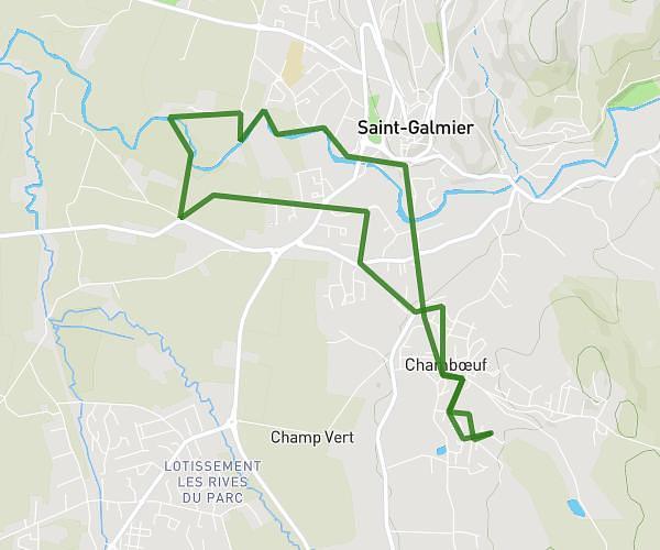
This running route covers 6.847mi starting from Veauche, Loire. The run is a loop trail and returns to the trailhead. This run is rated as moderate, expect about 1h10m to complete it. The route has an elevation gain of 69ft and an elevation loss of 66ft.
Foulées veauchoises
Route details
5.87mph
Speed
800 kcal
Calories burned
Loop trail
Route type
1270ft
Min altitude
1332ft
Max altitude
Route profile
69ft
Elevation gain
66ft
Elevation loss
1270ft
Min altitude
1332ft
Max altitude
How to get there
Trailhead: Rue Marcel Pagnol, 42340 Veauche
GPS coordinates of the trailhead: 45.56368, 4.30523 / 45°33'49'' N, 4°18'18'' E