MapPlanner
5.861mi
Distance
56m
Duration
9:33/mi
Pace
Moderate
Level

Veauche

Route details

6.28mph
Speed
640 kcal
Calories burned
Loop trail
Route type
1266ft
Min altitude
1306ft
Max altitude

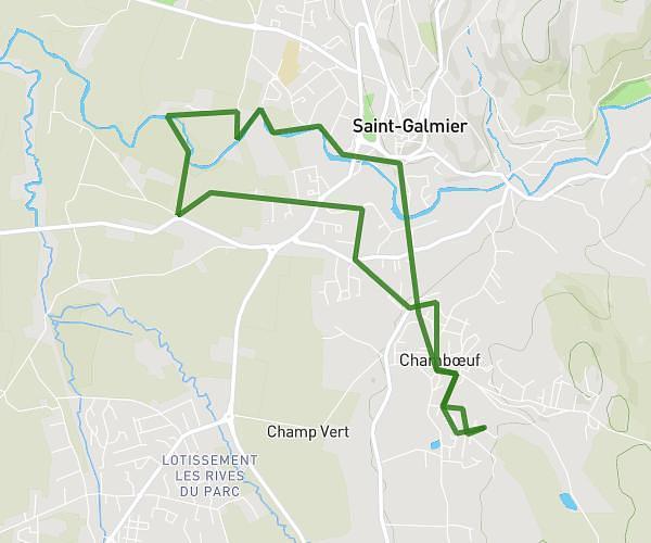
This running route covers 5.861mi starting from Veauche, Loire. The run is a loop trail and returns to the trailhead. This run is rated as moderate, expect about 56m to complete it. The route has an elevation gain of 39ft and an elevation loss of 33ft.

Route profile

39ft
Elevation gain
33ft
Elevation loss
1266ft
Min altitude
1306ft
Max altitude

How to get there

Trailhead: Rue Marcel Pagnol, 42340 Veauche

GPS coordinates of the trailhead: 45.56357, 4.30518 / 45°33'48'' N, 4°18'18'' E

Caution: May Cross Private Property

This route may pass through or near private property. Always respect posted signs, obtain permission where required, and follow local trespassing laws. MapPlanner does not guarantee public access along any route.

Safety Notice

Trail and road conditions may change without notice due to weather, construction, or other factors. Always verify current conditions before heading out. You are responsible for your own safety — follow local signage, obey traffic laws, and use your best judgment on the trail.