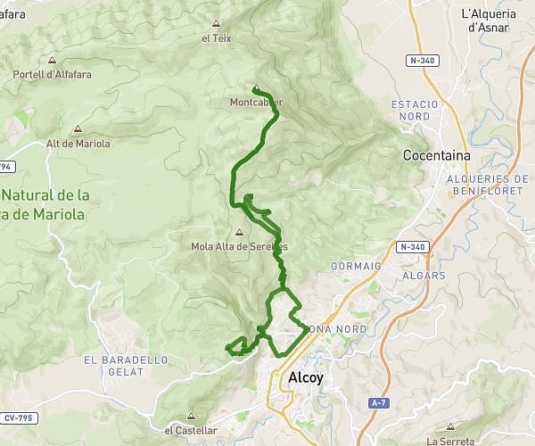
This running route covers 4.357mi starting from Muro de Alcoy, Alicante. The run is a loop trail and returns to the trailhead. This run is rated as easy, expect about 52m35s to complete it. The route has an elevation gain of 348ft and an elevation loss of 348ft.
Plana
Route details
4.97mph
Speed
601 kcal
Calories burned
Loop trail
Route type
1253ft
Min altitude
1509ft
Max altitude
Route profile
348ft
Elevation gain
348ft
Elevation loss
1253ft
Min altitude
1509ft
Max altitude
How to get there
Trailhead: Alqueria 9, 03830 Muro de Alcoy, Alicante, Spain
GPS coordinates of the trailhead: 38.780921, -0.432715 / 38°46'51'' N, 0°25'57'' W