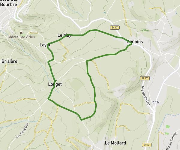
This walking route covers 3.71mi starting from Val-de-Virieu, Isère. The walk is a loop trail and returns to the trailhead. This walk is rated as moderate, plan for about 1h20m to complete it. The route has an elevation gain of 446ft and an elevation loss of 443ft.
La gone _ les marais
Route details
21:33/mi
Pace
327 kcal
Calories burned
Loop trail
Route type
1270ft
Min altitude
1532ft
Max altitude
Route profile
446ft
Elevation gain
443ft
Elevation loss
1270ft
Min altitude
1532ft
Max altitude
How to get there
Trailhead: 290 Chemin De Combe Paradis, 38730 Val-de-Virieu, France
GPS coordinates of the trailhead: 45.48046, 5.473 / 45°28'49'' N, 5°28'22'' E