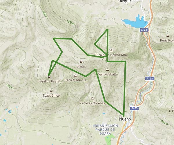
This running route covers 17.704mi starting from Nueno, Huesca. The run is a loop trail and returns to the trailhead. This run is rated as strenuous, expect about 4h4s to complete it. The route has an elevation gain of 6962ft and an elevation loss of 6778ft.
Calma Alta-Pico del Águila-Salro del Roldán
Route details
4.42mph
Speed
2745 kcal
Calories burned
Loop trail
Route type
2871ft
Min altitude
5148ft
Max altitude
Route profile
6962ft
Elevation gain
6778ft
Elevation loss
2871ft
Min altitude
5148ft
Max altitude
How to get there
Trailhead: Carretera De Santa Eulalia De La Peña, 22193 Nueno, Huesca, Spain
GPS coordinates of the trailhead: 42.2608, -0.40573 / 42°15'38'' N, 0°24'20'' W