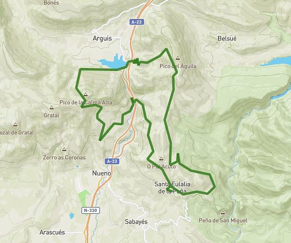
This running route covers 11.742mi starting from Nueno, Huesca. The run is a loop trail and returns to the trailhead. This run is rated as strenuous, expect about 3h to complete it. The route has an elevation gain of 3228ft and an elevation loss of 3212ft.
Pico del águila desde santa Eulalia
Route details
3.91mph
Speed
2058 kcal
Calories burned
Loop trail
Route type
2959ft
Min altitude
5233ft
Max altitude
Route profile
3228ft
Elevation gain
3212ft
Elevation loss
2959ft
Min altitude
5233ft
Max altitude
How to get there
Trailhead: Calle Baja 7, 22193 Nueno, Huesca, Spain
GPS coordinates of the trailhead: 42.262349, -0.406211 / 42°15'44'' N, 0°24'22'' W