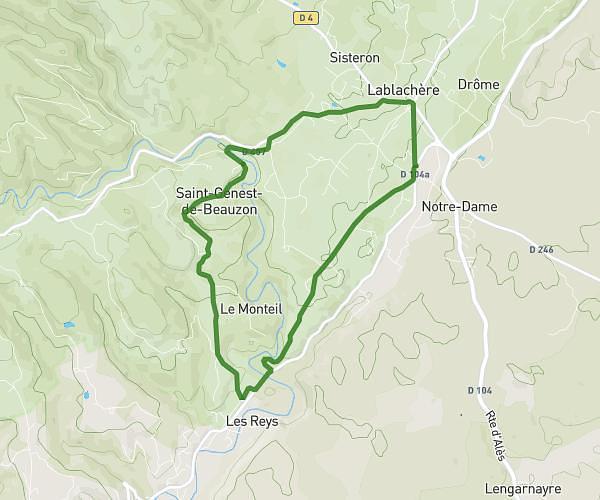
This running route covers 4.338mi starting from Saint-Germain, Ardèche. The run is a loop trail and returns to the trailhead. This run is rated as easy, expect about 42m to complete it. The route has an elevation gain of 197ft and an elevation loss of 197ft.
Lavilledieu 01
Route details
6.2mph
Speed
480 kcal
Calories burned
Loop trail
Route type
646ft
Min altitude
778ft
Max altitude
Route profile
197ft
Elevation gain
197ft
Elevation loss
646ft
Min altitude
778ft
Max altitude
How to get there
Trailhead: Rue De La Borne Milliaire, 07170 Saint-Germain
GPS coordinates of the trailhead: 44.5547, 4.45198 / 44°33'16'' N, 4°27'7'' E