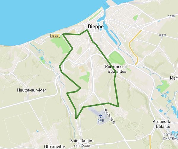
This hiking trail covers 18.276mi starting from Petit-Caux, Seine-Maritime. The hike does not return to the trailhead and ends near 2 Rue D'englesqueville, 76630 Petit-Caux, France. This hike is rated as hard, plan for about 7h21m to complete it. The route has an elevation gain of 1319ft and an elevation loss of 1322ft.
Entraînement avec Floriane et Philippe
Route details
2.49mph
Speed
3159 kcal
Calories burned
2.7%
Avg grade
Point to point
Route type
79ft
Min altitude
548ft
Max altitude
Route profile
1319ft
Elevation gain
1322ft
Elevation loss
79ft
Min altitude
548ft
Max altitude
How to get there
Trailhead: 2 Rue De Mahomet, 76630 Petit-Caux, France
GPS coordinates of the trailhead: 49.935695, 1.240029 / 49°56'8'' N, 1°14'24'' E