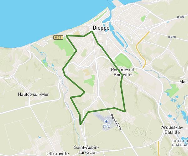
This hiking trail covers 6.485mi starting from Dieppe, Seine-Maritime. The hike is a loop trail and returns to the trailhead. This hike is rated as easy, plan for about 3h8m to complete it. The route has an elevation gain of 427ft and an elevation loss of 427ft.
RANDO UT 10
Route details
2.07mph
Speed
1343 kcal
Calories burned
2.5%
Avg grade
Loop trail
Route type
0ft
Min altitude
187ft
Max altitude
Route profile
427ft
Elevation gain
427ft
Elevation loss
0ft
Min altitude
187ft
Max altitude
How to get there
Trailhead: 101 Boulevard De Verdun, 76200 Dieppe, France
GPS coordinates of the trailhead: 49.92704, 1.07039 / 49°55'37'' N, 1°4'13'' E