MapPlanner
9.385mi
Distance
3h23m
Duration
+909ft
Elevation gain
-915ft
Elevation loss
Moderate
Level

Fanette 15 bornes

Route details

2.77mph
Speed
1464 kcal
Calories burned
3.7%
Avg grade
Loop trail
Route type
7ft
Min altitude
305ft
Max altitude

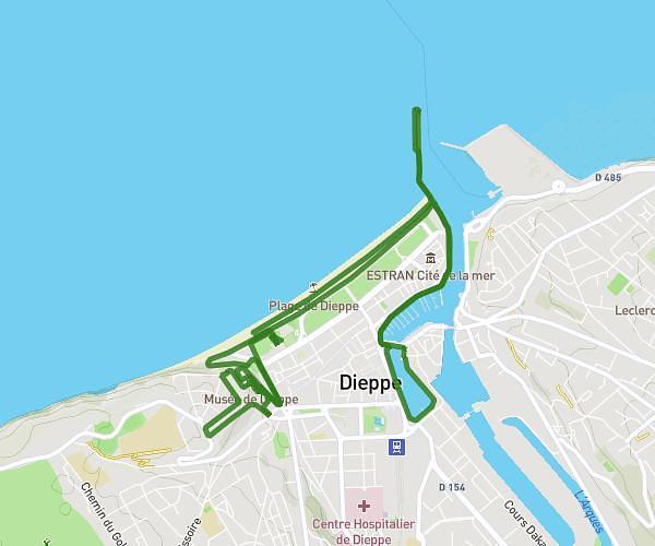
This hiking trail covers 9.385mi starting from Dieppe, Seine-Maritime. The hike is a loop trail and returns to the trailhead. This hike is rated as moderate, plan for about 3h23m to complete it. The route has an elevation gain of 909ft and an elevation loss of 915ft.

Route profile

909ft
Elevation gain
915ft
Elevation loss
7ft
Min altitude
305ft
Max altitude

How to get there

Trailhead: 2 Rue Langlois, 76200 Dieppe, France

GPS coordinates of the trailhead: 49.91575, 1.080119 / 49°54'56'' N, 1°4'48'' E

Caution: May Cross Private Property

This route may pass through or near private property. Always respect posted signs, obtain permission where required, and follow local trespassing laws. MapPlanner does not guarantee public access along any route.

Safety Notice

Trail and road conditions may change without notice due to weather, construction, or other factors. Always verify current conditions before heading out. You are responsible for your own safety — follow local signage, obey traffic laws, and use your best judgment on the trail.