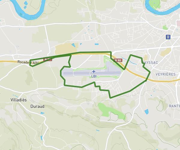
This running route covers 2.586mi starting from Blaye-les-Mines, Tarn. The run is a loop trail and returns to the trailhead. This run is rated as easy, expect about 31m12s to complete it. The route has an elevation gain of 410ft and an elevation loss of 443ft.
Albi
Route details
4.97mph
Speed
357 kcal
Calories burned
Loop trail
Route type
902ft
Min altitude
1125ft
Max altitude
Route profile
410ft
Elevation gain
443ft
Elevation loss
902ft
Min altitude
1125ft
Max altitude
How to get there
Trailhead: 1 Impasse Baudin, 81400 Blaye-les-Mines, France
GPS coordinates of the trailhead: 44.031053, 2.13371 / 44°1'51'' N, 2°8'1'' E