MapPlanner
6.66mi
Distance
1h
Duration
9:00/mi
Pace
Easy
Level

Arhhhhhhh

Route details

6.66mph
Speed
686 kcal
Calories burned
Point to point
Route type
489ft
Min altitude
604ft
Max altitude

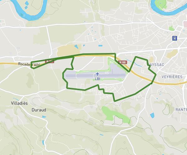
This running route covers 6.66mi starting from Albi, Tarn. The run does not return to the trailhead and ends near Rue Des Marannes, 81990 Le Sequestre, France. This run is rated as easy, expect about 1h to complete it. The route has an elevation gain of 364ft and an elevation loss of 361ft.

Description of the route by the creator

10km Albi

(Description automatically translated)

Route profile

364ft
Elevation gain
361ft
Elevation loss
489ft
Min altitude
604ft
Max altitude

How to get there

Trailhead: 100 Rue Des Portes D'albi, 81000 Albi, France

GPS coordinates of the trailhead: 43.919948, 2.111114 / 43°55'11'' N, 2°6'40'' E

Caution: May Cross Private Property

This route may pass through or near private property. Always respect posted signs, obtain permission where required, and follow local trespassing laws. MapPlanner does not guarantee public access along any route.

Safety Notice

Trail and road conditions may change without notice due to weather, construction, or other factors. Always verify current conditions before heading out. You are responsible for your own safety — follow local signage, obey traffic laws, and use your best judgment on the trail.