MapPlanner
4.626mi
Distance
50m
Duration
10:49/mi
Pace
Easy
Level

Blavet

Route details

5.55mph
Speed
572 kcal
Calories burned
Loop trail
Route type
13ft
Min altitude
66ft
Max altitude

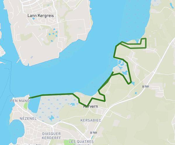
This running route covers 4.626mi starting from Lanester, Morbihan. The run is a loop trail and returns to the trailhead. This run is rated as easy, expect about 50m to complete it. The route has an elevation gain of 56ft and an elevation loss of 3ft.

Route profile

56ft
Elevation gain
3ft
Elevation loss
13ft
Min altitude
66ft
Max altitude

How to get there

Trailhead: 9 Rue Jules Verne, 56600 Lanester, France

GPS coordinates of the trailhead: 47.74484, -3.332002 / 47°44'41'' N, 3°19'55'' W

Caution: May Cross Private Property

This route may pass through or near private property. Always respect posted signs, obtain permission where required, and follow local trespassing laws. MapPlanner does not guarantee public access along any route.

Safety Notice

Trail and road conditions may change without notice due to weather, construction, or other factors. Always verify current conditions before heading out. You are responsible for your own safety — follow local signage, obey traffic laws, and use your best judgment on the trail.