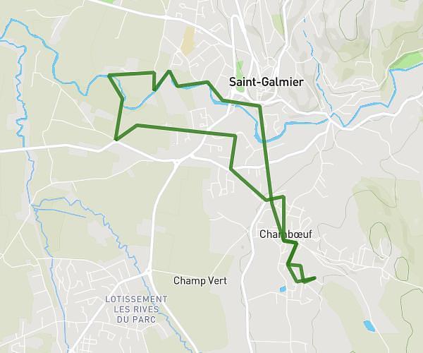
This running route covers 5.521mi starting from Chambœuf, Loire. The run does not return to the trailhead and ends near 1627 Route De Jourcey, 42330 Veauche, France. This run is rated as moderate, expect about 53m to complete it. The route has an elevation gain of 285ft and an elevation loss of 299ft.
Vers la Loire à Veauche
Route details
6.25mph
Speed
606 kcal
Calories burned
Point to point
Route type
1155ft
Min altitude
1276ft
Max altitude
Route profile
285ft
Elevation gain
299ft
Elevation loss
1155ft
Min altitude
1276ft
Max altitude
How to get there
Trailhead: 529 Route De Rivas, 42330 Chambœuf, France
GPS coordinates of the trailhead: 45.58469, 4.30054 / 45°35'4'' N, 4°18'1'' E