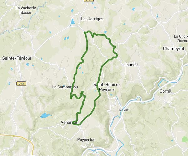
This running route covers 9.267mi starting from Laguenne-sur-Avalouze, Corrèze. The run is a loop trail and returns to the trailhead. This run is rated as moderate, expect about 1h39m to complete it. The route has an elevation gain of 1250ft and an elevation loss of 1240ft.
15 km laguenne
Route details
5.62mph
Speed
1132 kcal
Calories burned
Loop trail
Route type
768ft
Min altitude
1562ft
Max altitude
Route profile
1250ft
Elevation gain
1240ft
Elevation loss
768ft
Min altitude
1562ft
Max altitude
How to get there
Trailhead: 10 Impasse Hameau Puy Lacroix, 19150 Laguenne-sur-Avalouze, France
GPS coordinates of the trailhead: 45.23637, 1.78167 / 45°14'10'' N, 1°46'54'' E