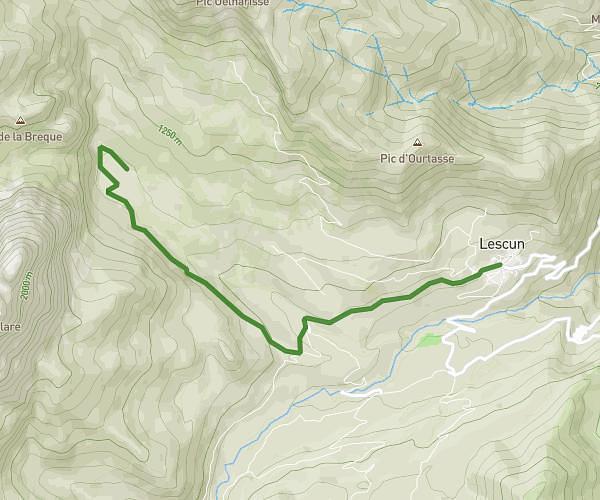
This walking route covers 3.185mi starting from Lescun, Pyrénées-Atlantiques. The walk does not return to the trailhead and ends near Tour Du Plateau De Sanchèse, 64490 Lescun. This walk is rated as moderate, plan for about 1h8m to complete it. The route has an elevation gain of 1050ft and an elevation loss of 302ft.
Lescun
Route details
21:22/mi
Pace
278 kcal
Calories burned
Point to point
Route type
2933ft
Min altitude
3681ft
Max altitude
Route profile
1050ft
Elevation gain
302ft
Elevation loss
2933ft
Min altitude
3681ft
Max altitude
How to get there
Trailhead: Rue Matachot, 64490 Lescun
GPS coordinates of the trailhead: 42.93408, -0.63501 / 42°56'2'' N, 0°38'6'' W