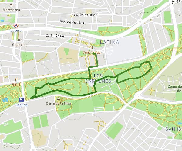
This running route covers 9.446mi starting from Madrid, Madrid. The run does not return to the trailhead and ends near Paseo Bajo De La Virgen Del Puerto 1, 28005 Madrid, Madrid, Spain. This run is rated as hard, expect about 1h50m to complete it. The route has an elevation gain of 72ft and an elevation loss of 341ft.
Ruta Malasaña
Route details
5.14mph
Speed
1260 kcal
Calories burned
Point to point
Route type
1965ft
Min altitude
2234ft
Max altitude
Route profile
72ft
Elevation gain
341ft
Elevation loss
1965ft
Min altitude
2234ft
Max altitude
How to get there
Trailhead: Calle Del Dos De Mayo 16d, 28004 Madrid, Madrid, Spain
GPS coordinates of the trailhead: 40.42695, -3.70399 / 40°25'37'' N, 3°42'14'' W