MapPlanner
3.299mi
Distance
53m5s
Duration
16:06/mi
Pace
Easy
Level

5km extérieur

Route details

3.73mph
Speed
607 kcal
Calories burned
Loop trail
Route type
66ft
Min altitude
151ft
Max altitude

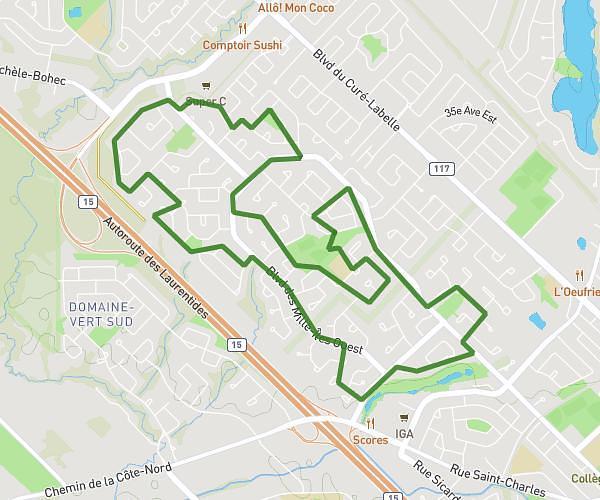
This running route covers 3.299mi starting from Laval, Quebec. The run is a loop trail and returns to the trailhead. This run is rated as easy, expect about 53m5s to complete it. The route has an elevation gain of 102ft and an elevation loss of 102ft.

Route profile

102ft
Elevation gain
102ft
Elevation loss
66ft
Min altitude
151ft
Max altitude

How to get there

Trailhead: Rue Émile-Joly, H7H 0B1 Laval

GPS coordinates of the trailhead: 45.63424, -73.76821 / 45°38'3'' N, 73°46'5'' W

Caution: May Cross Private Property

This route may pass through or near private property. Always respect posted signs, obtain permission where required, and follow local trespassing laws. MapPlanner does not guarantee public access along any route.

Safety Notice

Trail and road conditions may change without notice due to weather, construction, or other factors. Always verify current conditions before heading out. You are responsible for your own safety — follow local signage, obey traffic laws, and use your best judgment on the trail.