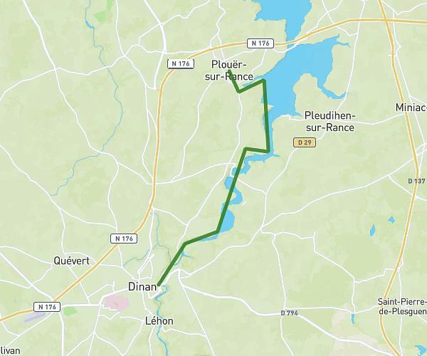
This hiking trail covers 4.33mi starting from Dinan, Côtes-d'Armor. The hike is a loop trail and returns to the trailhead. This hike is rated as easy, plan for about 1h9m to complete it. The route has an elevation gain of 354ft and an elevation loss of 354ft.
Parcours marcheurs jeudi
Route details
3.73mph
Speed
500 kcal
Calories burned
3.1%
Avg grade
Loop trail
Route type
144ft
Min altitude
272ft
Max altitude
Route profile
354ft
Elevation gain
354ft
Elevation loss
144ft
Min altitude
272ft
Max altitude
How to get there
Trailhead: Rue Des Antons, 22100 Dinan
GPS coordinates of the trailhead: 48.45216, -2.04424 / 48°27'7'' N, 2°2'39'' W