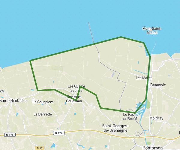
This hiking trail covers 10.579mi starting from Cherrueix, Ille-et-Vilaine. The hike does not return to the trailhead and ends near Digue Route, 50170 Le Mont-Saint-Michel, France. This hike is rated as easy, plan for about 3h26m to complete it. The route has an elevation gain of 92ft and an elevation loss of 85ft.
GR34
Route details
3.08mph
Speed
1446 kcal
Calories burned
0.3%
Avg grade
Point to point
Route type
10ft
Min altitude
33ft
Max altitude
Route profile
92ft
Elevation gain
85ft
Elevation loss
10ft
Min altitude
33ft
Max altitude
How to get there
Trailhead: 1 Rue Du Lion D'or, 35120 Cherrueix, France
GPS coordinates of the trailhead: 48.60519, -1.71145 / 48°36'18'' N, 1°42'41'' W