MapPlanner
7.026mi
Distance
2h20m
Duration
19:55/mi
Pace
Moderate
Level

7 Miles

Route details

3.01mph
Speed
1601 kcal
Calories burned
Loop trail
Route type
1063ft
Min altitude
1142ft
Max altitude

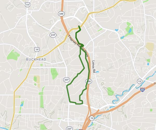
This running route covers 7.026mi starting from Marietta, Georgia. The run is a loop trail and returns to the trailhead. This run is rated as moderate, expect about 2h20m to complete it. The route has an elevation gain of 108ft and an elevation loss of 98ft.

Description of the route by the creator

Left out of hood

Route profile

108ft
Elevation gain
98ft
Elevation loss
1063ft
Min altitude
1142ft
Max altitude

How to get there

Trailhead: Weymouth Drive, 30062 Marietta

GPS coordinates of the trailhead: 34.02477, -84.44707 / 34°1'29'' N, 84°26'49'' W

Caution: May Cross Private Property

This route may pass through or near private property. Always respect posted signs, obtain permission where required, and follow local trespassing laws. MapPlanner does not guarantee public access along any route.

Safety Notice

Trail and road conditions may change without notice due to weather, construction, or other factors. Always verify current conditions before heading out. You are responsible for your own safety — follow local signage, obey traffic laws, and use your best judgment on the trail.