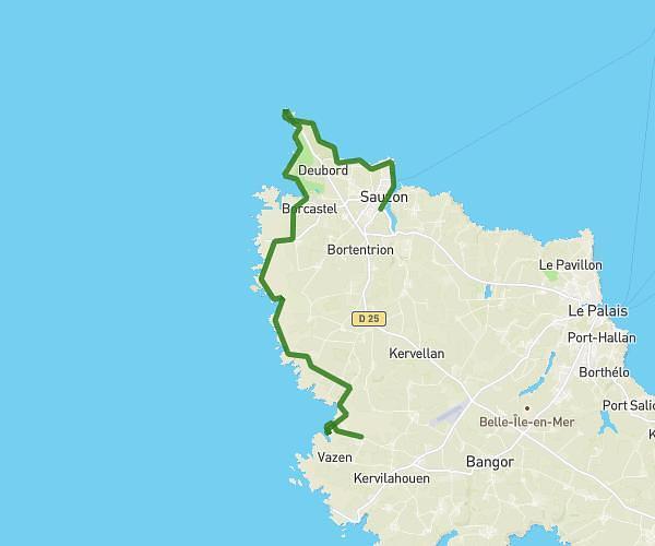
This hiking trail covers 5.21mi starting from Locmaria, Morbihan. The hike does not return to the trailhead and ends near 1 Rue Pasteur, 56360 Le Palais, France. This hike is rated as moderate, plan for about 1h57m to complete it. The route has an elevation gain of 892ft and an elevation loss of 971ft.
Jour 3 Les Grands Sables Le Palais
Route details
2.65mph
Speed
870 kcal
Calories burned
6.8%
Avg grade
Point to point
Route type
0ft
Min altitude
121ft
Max altitude
Route profile
892ft
Elevation gain
971ft
Elevation loss
0ft
Min altitude
121ft
Max altitude
How to get there
Trailhead: 479 Les Hauts Des Grands Sables, 56360 Locmaria, France
GPS coordinates of the trailhead: 47.314029, -3.105255 / 47°18'50'' N, 3°6'18'' W