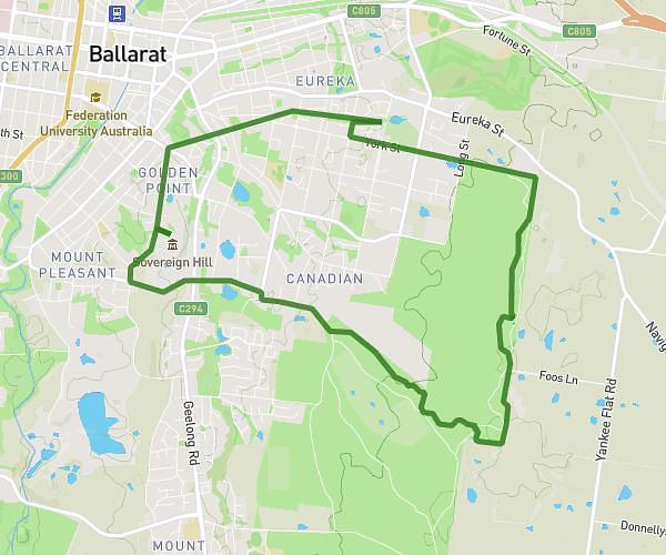
This hiking trail covers 12.382mi starting from Ballarat, Victoria. The hike does not return to the trailhead and ends near 5 Water Street, Creswick Victoria 3363, Australia. This hike is rated as moderate, plan for about 3h52m to complete it. The route has an elevation gain of 771ft and an elevation loss of 863ft.
brownhill to Creswick
Route details
3.2mph
Speed
1656 kcal
Calories burned
2.5%
Avg grade
Point to point
Route type
1398ft
Min altitude
1972ft
Max altitude
Route profile
771ft
Elevation gain
863ft
Elevation loss
1398ft
Min altitude
1972ft
Max altitude
How to get there
Trailhead: 381 Humffray Street North, Brown Hill Victoria 3350, Australia
GPS coordinates of the trailhead: -37.55236, 143.89849 / 37°33'8'' S, 143°53'54'' E