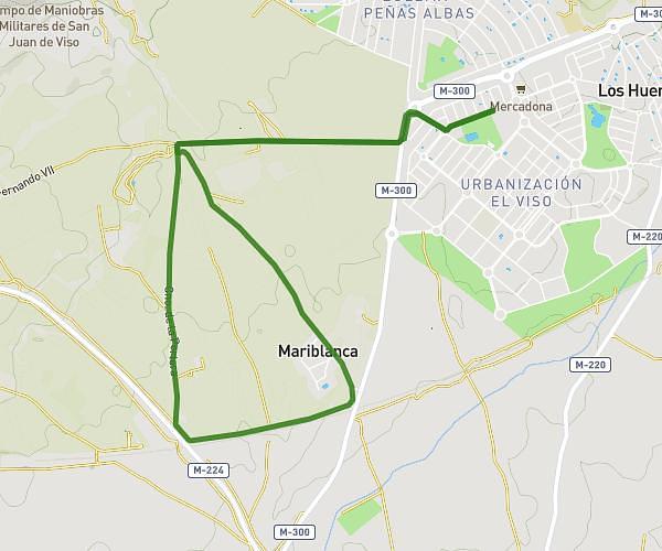
This running route covers 2.787mi starting from Villalbilla, Madrid. The run does not return to the trailhead and ends near Calle De José De Ceca, 28810 Villalbilla, Madrid, Spain. This run is rated as easy, expect about 29m54s to complete it. The route has an elevation gain of 197ft and an elevation loss of 233ft.
Calentamiento y series
Route details
5.59mph
Speed
342 kcal
Calories burned
Point to point
Route type
2106ft
Min altitude
2221ft
Max altitude
Route profile
197ft
Elevation gain
233ft
Elevation loss
2106ft
Min altitude
2221ft
Max altitude
How to get there
Trailhead: Camino De La Isabela 3, 28810 Villalbilla, Madrid, Spain
GPS coordinates of the trailhead: 40.443702, -3.366019 / 40°26'37'' N, 3°21'57'' W