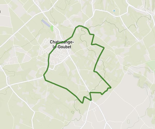
This running route covers 16.125mi starting from Guilherand-Granges, Ardèche. The run is a loop trail and returns to the trailhead. This run is rated as strenuous, expect about 1h37m to complete it. The route has an elevation gain of 1266ft and an elevation loss of 1207ft.
dfg
Route details
9.97mph
Speed
1109 kcal
Calories burned
Loop trail
Route type
236ft
Min altitude
1503ft
Max altitude
Route profile
1266ft
Elevation gain
1207ft
Elevation loss
236ft
Min altitude
1503ft
Max altitude
How to get there
Trailhead: 60 Rue Jules Ferry, 07500 Guilherand-Granges, France
GPS coordinates of the trailhead: 44.93814, 4.87648 / 44°56'17'' N, 4°52'35'' E