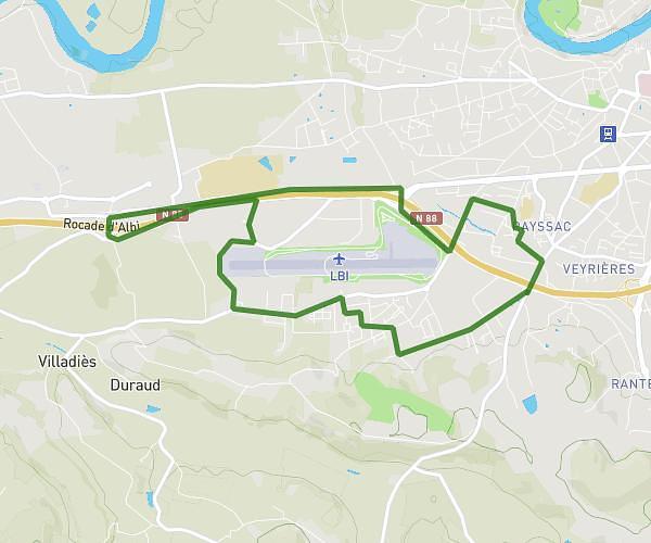
This running route covers 0.952mi starting from Le Sequestre, Tarn. The run is a loop trail and returns to the trailhead. This run is rated as easy, expect about 10m to complete it. The route has an elevation gain of 52ft and an elevation loss of 49ft.
Elisa S.
Route details
5.71mph
Speed
114 kcal
Calories burned
Loop trail
Route type
568ft
Min altitude
604ft
Max altitude
Route profile
52ft
Elevation gain
49ft
Elevation loss
568ft
Min altitude
604ft
Max altitude
How to get there
Trailhead: Avenue Marcel Pagnol, 81990 Le Sequestre
GPS coordinates of the trailhead: 43.90921, 2.11638 / 43°54'33'' N, 2°6'58'' E