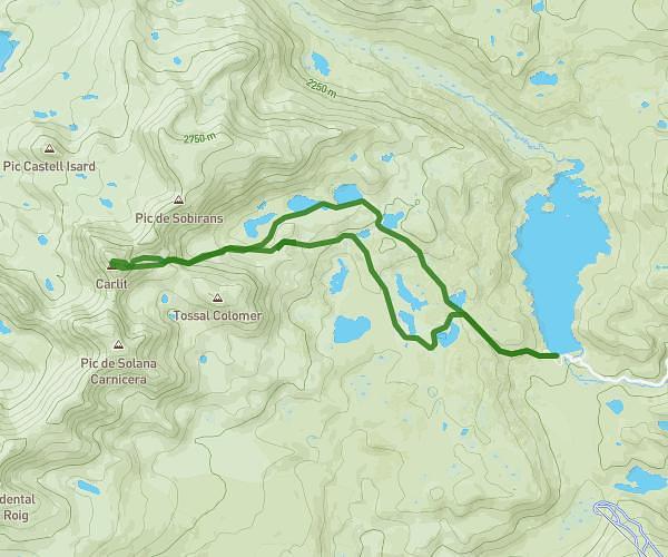
This hiking trail covers 2.547mi starting from Angoustrine-Villeneuve-des-Escaldes, Les Angles, Pyrénées-Orientales. The hike is a loop trail and returns to the trailhead. This hike is rated as strenuous, plan for about 2h7m to complete it. The route has an elevation gain of 1699ft and an elevation loss of 1703ft.
Pic Carlit
Route details
1.21mph
Speed
1076 kcal
Calories burned
25.3%
Avg grade
Loop trail
Route type
7749ft
Min altitude
9446ft
Max altitude
High altitude
Steep climb
Route profile
1699ft
Elevation gain
1703ft
Elevation loss
7749ft
Min altitude
9446ft
Max altitude
How to get there
Trailhead: 66760, Angoustrine-Villeneuve-des-Escaldes, Pyrénées-Orientales, France
GPS coordinates of the trailhead: 42.57151, 1.95252 / 42°34'17'' N, 1°57'9'' E