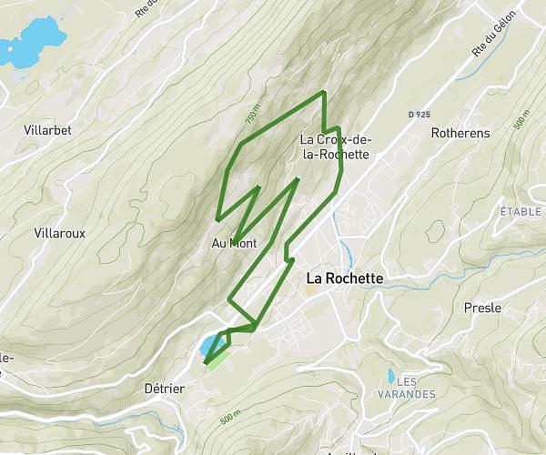
This running route covers 16.952mi starting from Fontcouverte-la-Toussuire, Savoie. The run is a loop trail and returns to the trailhead. This run is rated as strenuous, expect about 2h44m to complete it. The route has an elevation gain of 2575ft and an elevation loss of 2306ft.
Refuge étendar
Route details
6.2mph
Speed
1875 kcal
Calories burned
Loop trail
Route type
5551ft
Min altitude
7940ft
Max altitude
Route profile
2575ft
Elevation gain
2306ft
Elevation loss
5551ft
Min altitude
7940ft
Max altitude
How to get there
Trailhead: 260 Rue Des Nivéoles, 73300 Fontcouverte-la-Toussuire, France
GPS coordinates of the trailhead: 45.25636, 6.26238 / 45°15'22'' N, 6°15'44'' E