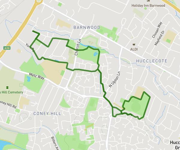
This walking route covers 1.373mi starting from Gloucester, England. The walk does not return to the trailhead and ends near Chapel Hay Lane, GL3 2ET Gloucester. This walk is rated as easy, plan for about 22m to complete it. The route has an elevation gain of 98ft and an elevation loss of 16ft.
Getting the car!
Route details
16:02/mi
Pace
90 kcal
Calories burned
Point to point
Route type
79ft
Min altitude
164ft
Max altitude
Route profile
98ft
Elevation gain
16ft
Elevation loss
79ft
Min altitude
164ft
Max altitude
How to get there
Trailhead: Craven Drive, GL3 2DZ Gloucester
GPS coordinates of the trailhead: 51.88536, -2.18366 / 51°53'7'' N, 2°11'1'' W