MapPlanner
4.253mi
Distance
2h4s
Duration
28:14/mi
Pace
Easy
Level

Evening walk

Route details

28:14/mi
Pace
490 kcal
Calories burned
Loop trail
Route type
30ft
Min altitude
72ft
Max altitude

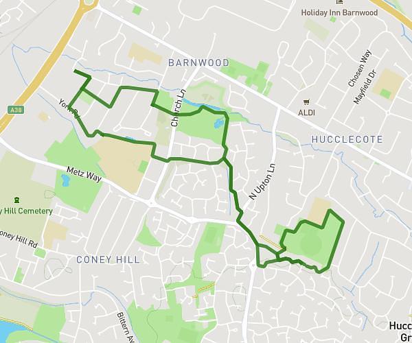
This walking route covers 4.253mi starting from Tewkesbury, England. The walk is a loop trail and returns to the trailhead. This walk is rated as easy, plan for about 2h4s to complete it. The route has an elevation gain of 138ft and an elevation loss of 131ft.

Description of the route by the creator

First walk off duty dipping toes in the river saying hello to the mounted police and blackberry picking

Route profile

138ft
Elevation gain
131ft
Elevation loss
30ft
Min altitude
72ft
Max altitude

How to get there

Trailhead: 1 Brookside, Tewkesbury, GL20 8BE, United Kingdom

GPS coordinates of the trailhead: 52.00084, -2.14343 / 52°0'3'' N, 2°8'36'' W

Caution: May Cross Private Property

This route may pass through or near private property. Always respect posted signs, obtain permission where required, and follow local trespassing laws. MapPlanner does not guarantee public access along any route.

Safety Notice

Trail and road conditions may change without notice due to weather, construction, or other factors. Always verify current conditions before heading out. You are responsible for your own safety — follow local signage, obey traffic laws, and use your best judgment on the trail.