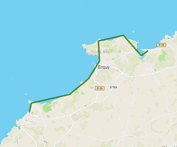
This hiking trail covers 5.618mi starting from Erquy, Côtes-d'Armor. The hike does not return to the trailhead and ends near 9 Rue De La Saline, 22430 Erquy, France. This hike is rated as moderate, plan for about 2h15m to complete it. The route has an elevation gain of 761ft and an elevation loss of 761ft.
sortie cap d'Erquy
Route details
2.49mph
Speed
990 kcal
Calories burned
5.1%
Avg grade
Point to point
Route type
16ft
Min altitude
197ft
Max altitude
Route profile
761ft
Elevation gain
761ft
Elevation loss
16ft
Min altitude
197ft
Max altitude
How to get there
Trailhead: 3 Rue Du Parc Des Sports, 22430 Erquy, France
GPS coordinates of the trailhead: 48.630144, -2.464093 / 48°37'48'' N, 2°27'50'' W